
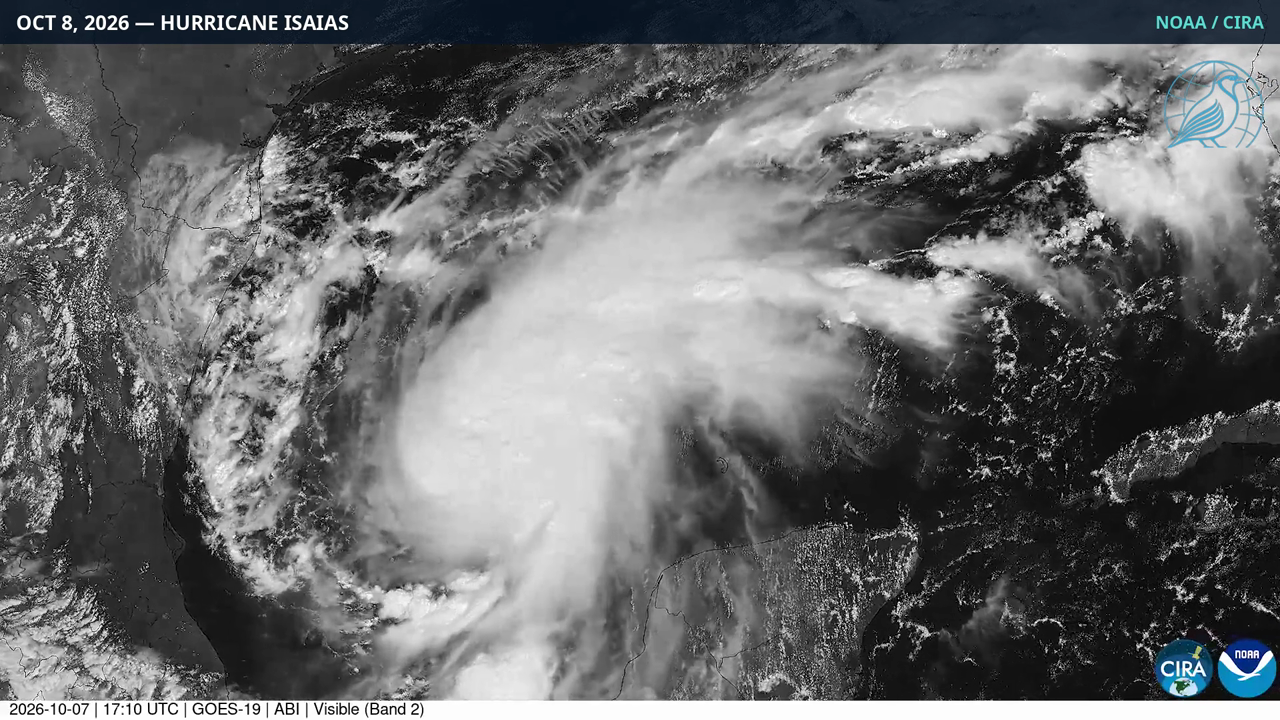
MIAMI — Hurricane Isaias became the first hurricane of the 2026 Atlantic season late Wednesday night, less than a day after forming as a tropical storm in the Gulf of Mexico. By Thursday morning, the National Hurricane Center said the storm was about 420 miles south-southwest of the mouth of the Mississippi River, with 80 mph winds — forecast to strengthen to near 110 mph before making landfall late Friday along the northern Gulf Coast.
Why it matters
Isaias is the latest first hurricane of an Atlantic season in 121 years, matching a record set on October 8, 1905. The 2026 season was the first in the satellite era without a single hurricane through September, normally the peak month. Meteorologists blame a powerful El Niño that has suppressed Atlantic storms all season with hostile wind shear and sinking dry air. It would also be the first hurricane to strike the United States since Hurricane Milton in 2024.
What we know
- Formation: Tropical Storm Isaias formed early Wednesday in the southwestern Gulf — the season’s ninth named storm — and became a hurricane by late Wednesday evening, reaching 75 mph by about 10:30 p.m. CDT (NHC via EarthSky).
- Forecast: The hurricane center forecasts a peak near 110 mph Friday — just under the 111-mph Category 3 threshold. “The system is forecast to remain a dangerous hurricane through landfall,” NHC specialist Brad Reinhart wrote. Director Mike Brennan said a major-hurricane peak is possible, according to the AP.
- Landfall: Late Friday night or early Saturday along the northern Gulf Coast, between coastal Mississippi and the Florida Panhandle, most likely as a Category 1 or Category 2 hurricane.
- Warnings: Hurricane warnings from Ocean Springs, Mississippi, to the Bay-Gulf County line in Florida. A storm-surge warning from the mouth of the Mississippi River to Florida’s Steinhatchee River, with up to 7 feet of surge possible.
- Rain and tornadoes: 3 to 7 inches of rain along the Gulf Coast, up to 10 inches locally. NOAA warns of isolated tornadoes in parts of Alabama, Florida, and southwestern Georgia.
- Preparations: Florida Gov. Ron DeSantis declared a state of emergency for 25 counties; Alabama Gov. Kay Ivey did the same for 40 counties. Okaloosa County, Florida, ordered mandatory coastal evacuations; several school districts canceled classes, the AP reported. Some Gulf oil wells paused production.
What we still don’t know
- The exact landfall point remains uncertain — the forecast cone is still wide, and significant impacts will extend well east of wherever the center comes ashore.
- Whether it reaches Category 3. The official forecast keeps the peak just below major-hurricane strength, but the NHC director says it is possible. Surge and rainfall are major threats either way.
- Whether the 121-year record is truly broken. Before the satellite era began in the 1960s, a hurricane that never reached land could pass unnoticed, so researchers caution against an absolute record claim.
- Inland impacts after landfall. The remnants are expected to track north through the Southeast toward Tennessee and the Carolinas, but exact rainfall totals and flood risk are still taking shape. Casualty and damage figures do not yet exist.
What’s next
- Thursday: Officials say preparations to protect life and property should be rushed to completion.
- Friday into Saturday: Landfall, with the greatest storm-surge concern between Ocean Springs, Mississippi, and Indian Pass, Florida, according to the NHC director.
- Weekend: Heavy rain spreads into the Southeast and Tennessee Valley. The storm could disrupt Saturday’s Georgia–Alabama college football game, which President Donald Trump plans to attend, the AP reported.
Timeline
- Wed, Oct. 7 (morning): Tropical Storm Isaias forms in the southwestern Gulf — the season’s ninth named storm.
- Wed, Oct. 7 (evening): Isaias becomes the season’s first hurricane (75 mph); hurricane warnings issued; Florida and Alabama declare states of emergency.
- Thu, Oct. 8 (morning): Isaias at 80 mph; NHC forecasts a Category 2 peak near 110 mph Friday. Mandatory coastal evacuations begin in Okaloosa County, Florida.
- Fri, Oct. 9: Forecast peak intensity; tropical-storm-force winds arrive along the Gulf Coast by afternoon. Landfall expected late Friday night or early Saturday.
- Sat–Sun: Storm moves inland; heavy rain and tornado risk across the Southeast; remnants track toward the Carolinas and Mid-Atlantic.
Read our original coverage: Hurricane Isaias Bears Down on Gulf Coast, Forecast to Strike Near Major Strength and Watch: Satellite Loop Shows Hurricane Isaias Organizing in the Gulf.