
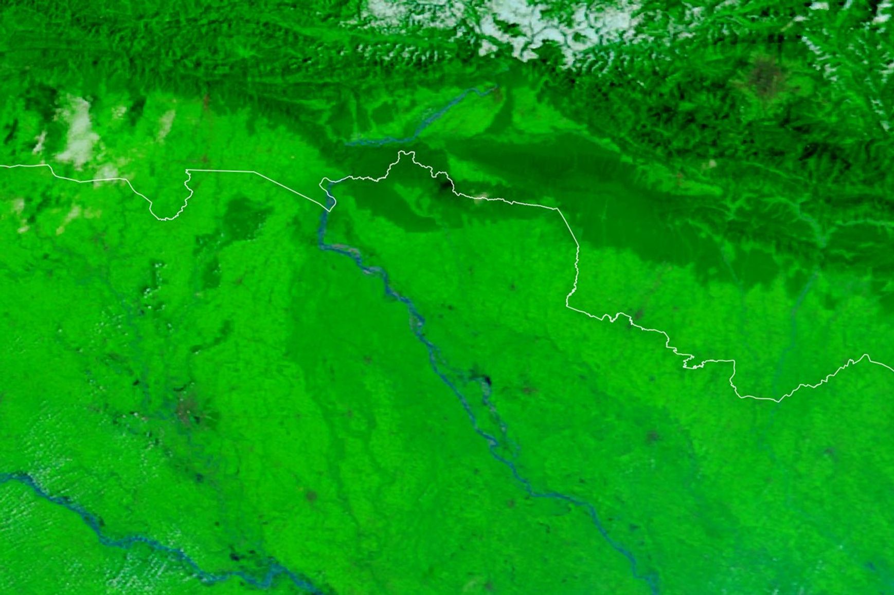
Before-and-after satellite images show the Gandak-Narayani River spreading across its floodplain after late-monsoon downpours pushed gauges to record levels in Nepal and northern India.
New imagery published by NASA Earth Observatory on October 2 compares the river corridor before and during the flooding. The Moderate Resolution Imaging Spectroradiometer, or MODIS, aboard NASA’s Terra and Aqua satellites captured the scenes on September 20 and September 29, 2026.
Before: September 20
During the flood: September 29
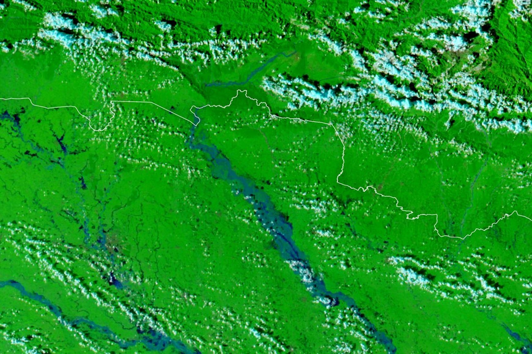
These are false-color images, not natural-color photographs. They combine infrared and visible-light observations using MODIS bands 7-2-1 so water is easier to distinguish: floodwater appears blue, vegetation bright green and clouds light blue.
Record water at Devghat
NASA said torrential rain soaked Nepal’s Lumbini and Gandaki provinces from September 24 through 27. At Devghat in Chitwan district, Nepal’s Department of Hydrology and Meteorology recorded the Narayani at 11.94 metres at 2:10 p.m. on September 27, according to the state-run Radio Nepal and OnlineKhabar. Both reports described it as the highest reading since measurements began at the station in 1963. The level was well above the station’s 9-metre danger mark.
The transboundary river is called the Narayani in southern Nepal and the Gandak in India. It flows south into northern Bihar and meets the Ganges near Hajipur. The Government of Bihar describes it as a major left-bank tributary of the Ganges.
In India, floodwater breached embankments and reached settlements and farmland along the Gandak. The Indian Express reported a breach near Bagaha after heavy runoff from the river’s Nepal catchment, while India’s public broadcaster News on Air reported more than 200 villages affected in northern Bihar.
Image rights and credit
The two images above are the unmodified JPEGs supplied with NASA Earth Observatory’s October 2 report. NASA’s media-use guidelines permit factual editorial use by news organizations with acknowledgment and without implying agency endorsement. The NASA page identifies no third-party copyright holder for either image. Zark News has not added a logo or altered the imagery.
Reporting by Zark News, based on NASA Earth Observatory imagery and reporting from Nepal and India. Image credit: NASA Earth Observatory / Lauren Dauphin, using MODIS data from NASA EOSDIS LANCE and GIBS/Worldview.