
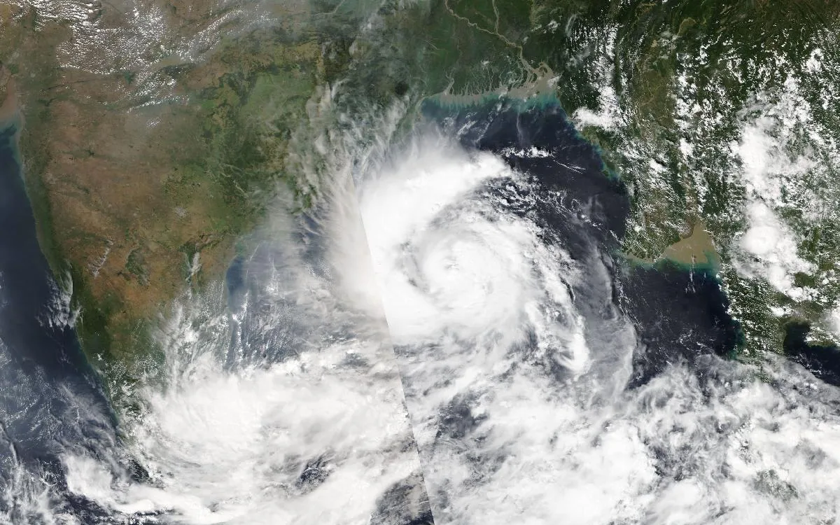
Evacuations were due to begin on Monday evening along India’s eastern coast as Cyclone Arnab strengthened over the Bay of Bengal and headed for Andhra Pradesh, where officials said they had identified 570,000 people as vulnerable to the storm.
The figure, given to Reuters by a senior Andhra Pradesh disaster management official, is the number of people assessed to be at risk in the storm’s path — not a count of people already moved. Officials said evacuations from vulnerable coastal areas would start on Monday evening.
The India Meteorological Department (IMD) said Arnab was centred at 11:30 a.m. IST on Monday over the west-central and adjoining east-central Bay of Bengal, about 580 km east-southeast of Visakhapatnam, and was moving nearly westwards at 13 kph. In its coastal bulletin, the IMD said the storm was very likely to intensify into a severe cyclonic storm by Monday evening and into a very severe cyclonic storm on Tuesday.
The department forecast that Arnab would then turn northwestwards and cross the Andhra Pradesh and Yanam coasts between Bapatla and Visakhapatnam, close to Yanam, by the forenoon of Wednesday, October 28, with maximum sustained winds of 115–125 kph gusting to 140 kph. The IMD also warned of a storm surge of about 1 to 1.5 metres above the astronomical tide, expected to inundate low-lying coastal areas, with the highest surge forecast over East Godavari, Kakinada and Yanam.
Heavy to extremely heavy rainfall is forecast over coastal Andhra Pradesh and Yanam on Tuesday and Wednesday, with heavy rain also expected in southern Odisha. A red alert has been issued for five southern Odisha districts, where isolated places could receive more than 20 cm of rain on Wednesday.
Andhra Pradesh has ordered boats at sea to return ashore and directed power utilities to restore supply quickly in case of disruption. Officials cited in Indian media reports said more than 4,800 fishing boats had returned to harbour along the Kakinada coast, and fishermen have been advised not to venture into the sea from October 26 to 29. The Indian Coast Guard has shepherded vessels to shore, according to a central government review chaired by the Cabinet Secretary, which placed Andhra Pradesh, Odisha, Telangana, Chhattisgarh and Puducherry on alert and set zero loss of life as the objective.
Andhra Pradesh has placed disaster response teams on standby and prepared control rooms and relief centres. Prakhar Jain, managing director of the state disaster management authority, said the next three days were “extremely crucial” and urged coastal residents to follow official advisories.
Neighbouring Odisha, which does not expect a landfall but faces heavy rain and gusty winds in its southern districts, has mobilised on a large scale. Chief Minister Mohan Charan Majhi said the state would “take no chances” and reiterated a zero-casualty goal. Around 60 Odisha Disaster Rapid Action Force teams and 17 NDRF teams have been deployed and 225 Fire Services teams placed on alert, he said. Schools, colleges and childcare centres in five southern districts are to close for two days, and in Ganjam district officials said 100 cyclone shelters had been kept ready, with 1,000 temporary sites identified if evacuations expand.
The Bay of Bengal is one of the world’s most active regions for tropical cyclones, and its storms have historically been among the deadliest: a super cyclone that struck Odisha in 1999 killed around 10,000 people. Since then, Odisha has built a network of cyclone shelters and an evacuation system that Indian officials credit with sharply reducing deaths in later storms such as Phailin in 2013 and Fani in 2019 — the model now being tested again as Arnab approaches.