
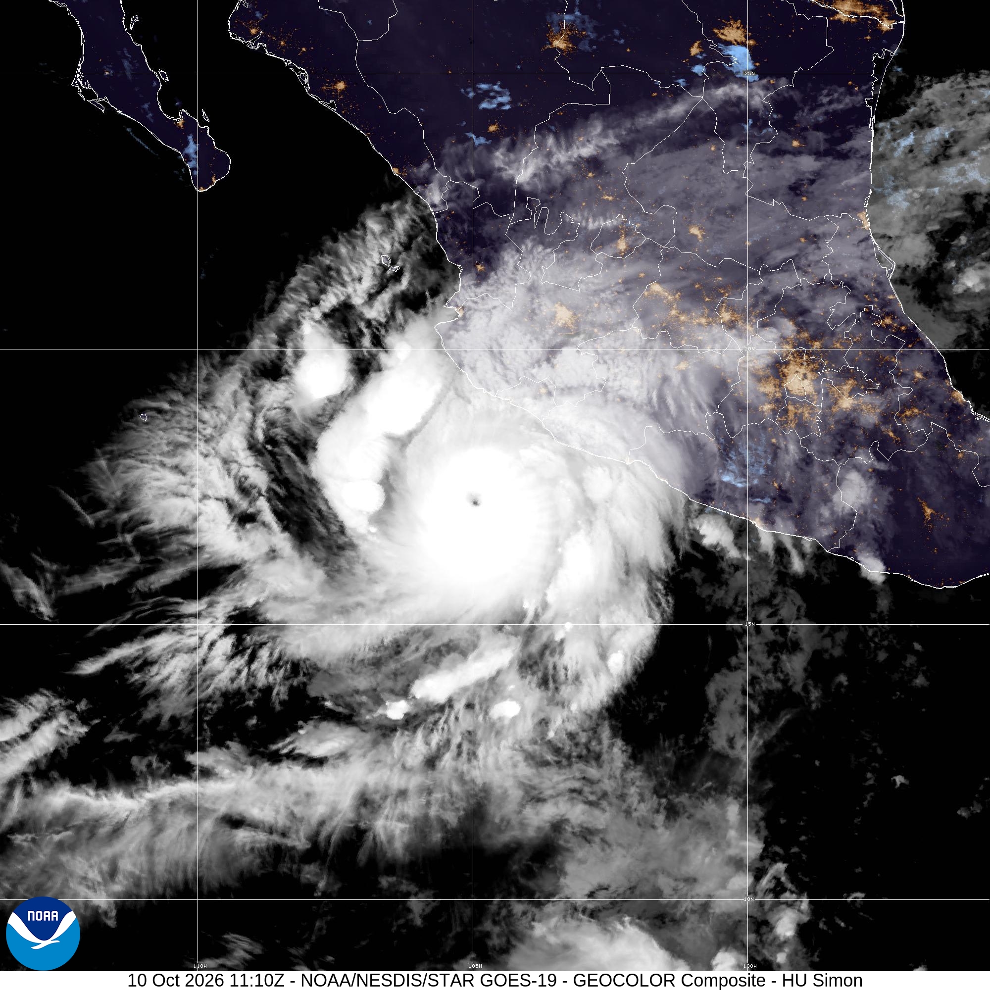
Updated October 10, 2026 | 3 a.m. CST NHC advisory. Hurricane Simon intensified into a Category 4 storm early Saturday, threatening Mexico’s west-central Pacific coast with destructive winds, dangerous storm surge and potentially catastrophic rainfall.
At 3 a.m. Central Standard Time, the U.S. National Hurricane Center estimated maximum sustained winds of 145 mph and a minimum central pressure of 942 millibars. Simon’s center was about 125 miles south of Manzanillo, moving north at 5 mph. The center had not yet made landfall as of that advisory.
Mexico prepares for severe impacts
The NHC warned that catastrophic wind damage and life-threatening storm surge were likely along parts of the west-central Mexican coast. A hurricane warning covered the coast from Punta San Telmo to Punta Mita. Officials urged residents in threatened areas to complete protective preparations and follow local emergency instructions.
Forecasters expect 10 to 20 inches of rain in parts of southwestern Mexico, with isolated totals up to 30 inches possible in Michoacán, Colima, Jalisco and Nayarit. Steep terrain raises the risk of dangerous flash flooding and landslides. Large waves and rip currents also threaten coastal communities.
Landfall track remains uncertain
Simon’s compact eye has allowed rapid strengthening, but small hurricanes can also change intensity quickly. The NHC forecast further strengthening and possible movement inland over Colima or Jalisco; a track just offshore could prolong dangerous coastal conditions. A forecast is not a confirmed landfall.
The Associated Press reported that authorities in Jalisco suspended classes in 22 municipalities and began evacuations in vulnerable areas. Residents should consult Mexico’s civil protection agencies and the latest NHC advisories rather than relying on older forecasts.
Official storm imagery and sources
Satellite animations and current storm imagery are available from NOAA/NESDIS. Credit: NOAA/NESDIS/CIRA as indicated on the selected imagery. The maps show cloud structure and movement, not confirmed ground damage.
Sources: National Hurricane Center, Advisory 12 and forecast discussion (October 10); Associated Press reporting. This developing report reflects the 3 a.m. CST advisory; intensity, warnings and track may change.